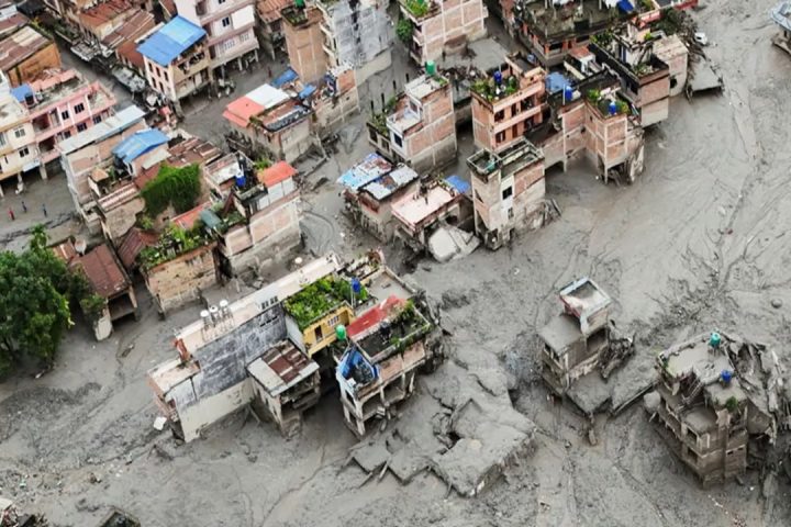

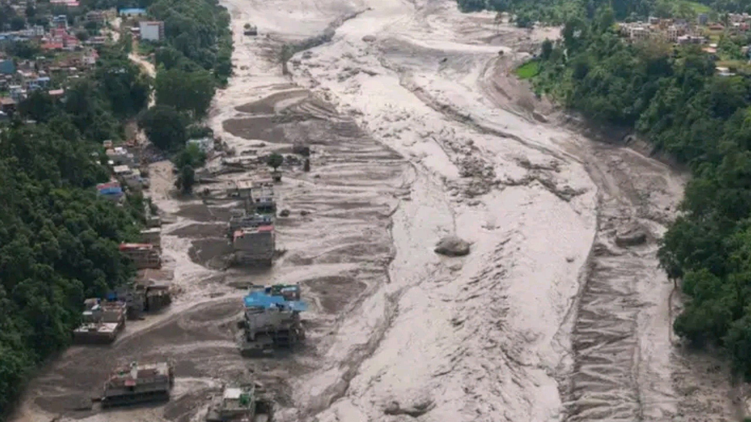
The disaster began with a magnitude 4.4 earthquake, recorded by the US Geological Survey roughly 100 kilometers north of Kathmandu near the Tibet border. Within minutes, an avalanche of rock and ice fell into the Lhende River in Tibet, known in Nepal as the Bhotekoshi, sending floodwaters crashing through Rasuwa and Nuwakot districts and into China’s Gyirong County. The confirmed death toll passed 160, with hundreds still missing, as the flood swept away villages, roads, and bridges.
Among the missing were over 400 people in Nepal, including dozens of US citizens. China’s state broadcaster reported the mudslide in Gyirong County killed at least three people and left hundreds more missing on its side of the border. The town of Timure, close to the Rasuwa border checkpoint, was almost entirely wiped out; before-and-after satellite images showed a river choked with debris where buildings once stood.
Why “Water Bomb” Is the Word on Everyone’s Lips
The term did not originate with this flood. It comes from a warning Indian officials have used for years about a much larger and more controversial project: China’s mega-dam on the Yarlung Tsangpo river in Tibet, which becomes the Brahmaputra once it crosses into India and later flows through Bangladesh.
Indian politicians have argued the dam gives China the ability to release destructive water surges across the border during any future conflict, a fear that Arunachal Pradesh’s chief minister has voiced directly by calling the project a “ticking water bomb.” He has warned that reduced flows during reservoir filling, or sudden releases afterward, could threaten communities living along the Siang river.
This week’s disaster, while triggered by a natural earthquake-avalanche chain rather than any dam, has still given that warning new weight. It is a reminder that the same Himalayan terrain hosting China’s dam-building program is also seismically volatile and prone to sudden glacial collapse, a combination that leaves downstream communities with almost no time to react.
The Infrastructure Gap Downstream
South Asia’s exposure comes down to geography and scale. An Indian government analysis reportedly found that the Yarlung Tsangpo project could cut dry-season flows to India by as much as 85 per cent under certain conditions, while also giving China the capacity to divert roughly a third of the river’s annual flow at a key border point. For Bangladesh, further downstream, the stakes are just as high: the dam would trap large volumes of sediment that currently replenish farmland, threatening food security in one of the world’s most densely populated river deltas.
Nepal’s own experience over the past two years shows how quickly infrastructure can be overwhelmed. Six hydropower and transmission facilities, including the Rasuwagadhi and Trishuli stations, were damaged or destroyed in this latest flood. A nearly identical disaster in July 2025 destroyed the Sino-Nepal Friendship Bridge and was traced to a glacial lake outburst on the Chinese side of the border. Neither event gave downstream communities meaningful advance warning.
China’s Position
Beijing has consistently defended its hydropower ambitions. A Chinese foreign ministry spokesperson said the project is meant to accelerate clean energy development and respond to climate change and extreme hydrological disasters, while promising no adverse effects for India and Bangladesh. Officials have also said the project remains in a planning and demonstration stage, with full consideration to be given to downstream interests before construction proceeds.
India has repeatedly pushed back on that reassurance. India’s Ministry of External Affairs has said it is closely monitoring the project and has consistently pressed China for greater transparency and consultation.
Discover More Stories Worth Your Time
Explore How To Buy Match Tickets?
Discover the easiest steps to secure cricket match tickets in Bangladesh.
Check Where Monsoon Travel Works?
Explore the best places to visit and areas to avoid during Bangladesh’s rainy season.
See Why India Visit Uncertain?
Discover how the Hasina extradition and Hadi murder case could affect Tarique Rahman’s India trip.
Find What Story Comes Next?
Explore what Tanim Noor may bring after Utsab and Bonolota Express.
Learn Why Saudi Invitation Matters?
Discover what the Saudi Crown Prince’s invitation could mean for Tarique Rahman’s upcoming visit.
What This Flood Really Signals
The Nepal flood was not caused by a dam failure, but it exposed something arguably more troubling: the entire eastern Himalayan water system, spanning Tibet, Nepal, India, and Bangladesh, still lacks a coordinated early warning network for glacial and seismic flood risk. Until that gap is closed, every new dam built upstream, however well engineered, adds one more variable to a system that has already proven it can turn deadly in minutes.
For India and Bangladesh, the flood is less a one-off tragedy than a preview. As Chinese dam construction continues on the Yarlung Tsangpo, the question facing policymakers in New Delhi and Dhaka is no longer hypothetical: it is how to prepare for a “water bomb” scenario that Himalayan geology has just demonstrated is entirely plausible, with or without a single dam gate ever being opened.
Summary: On August 26, 2026, a flash flood triggered by an earthquake and glacial collapse tore through Nepal’s Rasuwa and Nuwakot districts and China’s Gyirong County, killing more than 160 people and leaving over 1,300 missing. The disaster has reignited concerns about China’s dam-building program in the Himalayas, including the massive Yarlung Tsangpo hydropower project upstream of India and Bangladesh.