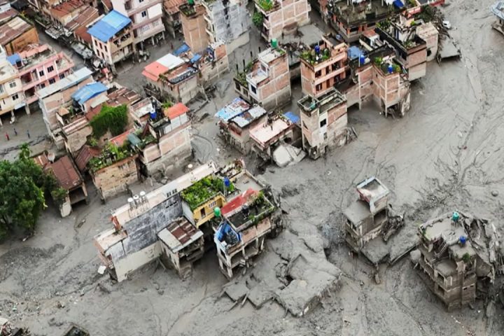


A geospatial study analyzing Landsat imagery from 1996 to 2021 across the Sari-Gowain and Piyan River systems found an increase of over 900 percent in silted land inside the haor basin, alongside a 42 percent decline in open water bodies. Medium-depth wetland areas, the zones best able to absorb and hold floodwater, shrank by more than 85 percent over the same period. In practical terms, land that used to store water now simply cannot, because rivers pouring down from the Meghalaya hills across the border keep dumping sediment into the basin faster than natural processes can clear it.
This is not a slow, uniform process. Researchers found that sediment concentration in the region’s rivers and wetlands has surged since 2011, with two out of every three water bodies in the haor region now carrying medium to high sediment loads.
Why The Riverbeds Keep Rising
Haors sit downstream of the Shillong Plateau, a steep, heavily eroded landscape that funnels enormous volumes of runoff and silt into Bangladesh during heavy rain. As that sediment settles, it raises the beds of the rivers and canals that are supposed to carry water away from the haors. A higher riverbed means less channel depth, which means water has nowhere to go but sideways and up, over the surrounding farmland, earlier and faster than before.
Local research has documented that sediment blockages in these river systems have slowed flood drainage by two to three times compared to earlier decades. Where a haor once absorbed a flood pulse and released it gradually, it now holds water longer and floods more violently when the drainage channels themselves are choked with silt.
The Toll On Farms And Fisheries
Sediment is not just a volume problem; it is a quality problem. Studies of farming communities in the haor basin found that heavy sand deposition strips topsoil of its ability to retain water and nutrients, while sulfur-rich sediment, some of it linked to coal particles washed down from upstream, makes the soil more acidic and less fertile. Farmers who once sowed rice directly into naturally fertile haor soil now depend on synthetic fertilizer just to match yields their parents got for free.
The damage compounds during flash floods. A widely cited case from the region’s flood history found that early flooding in low-lying Aman croplands, worsened by siltation, cut yields by as much as one and a half times normal losses in badly hit districts. Fisheries suffer too, as silted, shallower water disrupts the spawning grounds that haor fish depend on, squeezing another income source for the roughly 19 million people who live in and around the basin.
Discover More Stories Worth Your Time
Find Which Airport Hotels Fit?
Discover convenient hotels near Dhaka Airport for short layovers and overnight stays.
Learn How Rohingya Youth Lead?
Explore how young Rohingya are advancing education and gender equality in refugee camps.
Explore Why Colombia Declared Emergency?
Discover what the powerful earthquake means for Colombia and the latest emergency response.
Check Why Jaya’s Sarees Trend?
Discover why Jaya Ahsan’s elegant saree looks continue captivating fans online.
See Where Hasina’s Crisis Leads?
Explore the accountability debate surrounding Hasina, India, and Bangladesh’s political future.
Bangladesh’s Response So Far
In April 2026, Bangladesh’s Parliament passed the Haor and Wetland Conservation Act, a law aimed squarely at slowing this kind of degradation. It bans unauthorized filling, excavation, or sand and mineral extraction inside haors, prohibits construction that blocks natural water flow, and criminalizes the poisoning or electrocution of aquatic life in these wetlands as a non-bailable offence. The law also formalizes a permanent government department dedicated to haor and wetland management, based in Dhaka with the authority to open regional field offices.
The legislation addresses what happens inside the haors, but it cannot reach the source of the sediment itself, much of which originates across the border in India’s Meghalaya hills. That leaves Bangladesh managing the symptoms of a problem whose root cause lies largely outside its own jurisdiction.
A Shrinking Buffer Against A Wetter Future
Haors were never just scenic wetlands; they were flood buffers, fish nurseries, and farmland rolled into one seasonal system. As sedimentation eats into their capacity year after year, that buffer keeps getting thinner at exactly the moment climate shifts are making monsoon rainfall less predictable and flash floods more sudden. Without sustained dredging, cross-border cooperation on upstream erosion, and consistent enforcement of the new conservation law, the haors risk losing the very function that made them indispensable in the first place.